Click below to agree to the terms of use.
By clicking the I accept button at the bottom of this page, or by otherwise using the National Land Realty, LLC (“NLR”) website and accessing any content, you agree to be bound by the following terms of use, as updated from time to time (“Terms of Use”).
- Disclaimer about Information Provided. Maps available through this website contain representations of land features compiled from aerial photography, remote sensing technology, recorded deeds and plats, other public records and public data. Users of these maps are hereby notified that the aforementioned public primary information sources should be consulted for verification of the information contained in these maps. These maps are NOT A LAND SURVEY. National Land Realty, LLC, does not warrant the accuracy, reliability or timeliness of any information on this website, including, without limitation, any information relating to any prior sales of any real property, specifically including the purchase price. Portions of such information may be incorrect or not current. Any personal entity that relies on any information obtained from this website does so at his or her own risk. National Land Realty, LLC, hereby disclaims any and all liability arising from the information provided on this website. Any person or entity relying on information from this site does so at their own risk.
- Prohibited Uses. BY USING THE NLR WEBSITE, YOU AGREE NOT TO:
- reproduce, modify, distribute, display or otherwise provide access to, create derivative works from, decompile, disassemble, or reverse engineer any portion of the website or the services provided by the website, except as explicitly permitted under these Terms of Use;
- reproduce, publicly display, or otherwise make accessible on or through any other website, application, or service any reviews, ratings, and/or profile information about real estate, lending, or other professionals, underlying images of or information about real estate listings, or other data or content available through the NLR website, except as explicitly permitted by NLR;
- conduct automated queries (including screen and database scraping, spiders, robots, crawlers, bypassing “captcha” or similar precautions, and any other automated activity with the purpose of obtaining information from the NLR website) on the NLR website;
- Indemnification. You agree to indemnify, defend, and hold harmless NLR, its affiliates, and their respective directors, officers, employees, and agents from any and all claims and demands made by any third party due to or arising out of: (a) your access to or use of the NLR website; (b) your breach of these Terms of Use; (c) your violation of any law or the rights of a third party; (d) any dispute or issue between you and any third party; and (e) your willful misconduct. NLR reserves the right, at its own expense, to assume the exclusive defense and control of any matter otherwise subject to indemnification by you, and in that case, you agree to cooperate with NLR’s defense of that claim.
- No Warranties. THE SERVICES AND INFORMATION PROVIDED ON NLR’S WEBSITE ARE PROVIDED "AS IS," "WITH ALL FAULTS" AND "AS AVAILABLE," AND THE ENTIRE RISK AS TO SATISFACTORY QUALITY, PERFORMANCE, ACCURACY, AND EFFORT IS WITH YOU. TO THE MAXIMUM EXTENT PERMITTED BY APPLICABLE LAW, NLR AND ITS SUPPLIERS MAKE NO REPRESENTATIONS, WARRANTIES OR CONDITIONS, EXPRESS OR IMPLIED. NLR AND ITS SUPPLIERS EXPRESSLY DISCLAIM ANY AND ALL WARRANTIES OR CONDITIONS, EXPRESS, STATUTORY AND IMPLIED. NO ADVICE OR INFORMATION, WHETHER ORAL OR WRITTEN, OBTAINED BY YOU THROUGH THE NLR WEBSITE OR ANY MATERIALS AVAILABLE THROUGH THE NLR WEBSITE WILL CREATE ANY WARRANTY REGARDING ANY NLR ENTITY OR THE NLR WEBSITE THAT IS NOT EXPRESSIVELY STATED IN THESE TERMS OF USE. YOU ASSUME ALL RISK FOR ANY DAMAGE THAT MAY RESULT FROM YOUR USE OF OR ACCESS TO THE NLR WEBSITE, AND ANY MATERIALS, INCLUDING ALL NLR MATERIALS, AVAILABLE THROUGH THE NLR WEBSITE. YOU UNDERSTAND AND AGREE THAT YOUR USE OF THE NLR WEBSITE, AND USE, ACCESS, DOWNLOAD, OR OTHERWISE OBTAINMENT OF MATERIALS THROUGH THE NLR WEBSITE, ARE AT YOUR OWN DISCRETION AND RISK, AND THAT YOU ARE SOLELY RESPONSIBLE FOR ANY DAMAGE TO YOUR PROPERTY (INCLUDING YOUR COMPUTER SYSTEM OR MOBILE DEVICE USED IN CONNECTION WITH THE NLR WEBSITE), OR THE LOSS OF DATA THAT RESULTS FROM THE USE OF THE NLR WEBSITE. SOME JURISDICTIONS MAY PROHIBIT A DISCLAIMER OR WARRANTIES AND YOU MAY HAVE OTHER RIGHTS THAT VARY FROM JURISDICTION TO JURISDICTION.
Why You'll Love It
Here is your chance to own an island, a big island! It is in the Ohio River, near Evansville, Indiana. Do some white-tail deer hunting, create a hunt club, or use it for your quiet enjoyment.
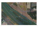
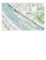
French Island No. 2 is a 2.8-mile-long island in the Ohio River between Henderson and Owensboro, in Daviess County, Kentucky. The island is 1,260 feet wide per Google Earth. The treed perimeter serves as erosion control. The island is nearly all Huntington soils which will produce outstanding covers and tree growth for wildlife.
Parcel #/ID
GIS Parcel ID 18-1
Legal Information
DB 922 PG 470
Deed of easement DB 1060 PG 853
Unit Size:
12,000,000 SF
Property Highlights
| Farms & Ranches | Wetlands Reserve Program |
| Hunting, Fishing & Recreation | Fishing, Waterfowl, Turkey, Whitetail Deer, River/Creek/Stream, Boating, Camping, Hiking, Canoeing/Kayaking, Silent Sports/Nature |
| Homes, Cabins, Acreages & Lots | Waterfront |
| Energy & Natural Resources | Oil and Gas Mineral Rights |
- Undeveloped bird hunting and hunt leases are allowed during non-nesting or brood rearing months. Ideal for hunt club. Hunting tract.
- White tail deer cross the river from the Indiana side. Deer trails are all over the hunt property island. The island is very level providing easy hunting,
- Your boat ride from the Indiana side is 600 feet and 3000 feet from the Kentucky side per Google Earth. The land on both sides of the river of level bottom cropland, incredible sunrise and sunset views.
- Your gateway to peace and seclusion. Unique opportunity for wherever your outdoor passion leads you.
- NRCS Wetland Reserve Program Easement
Estimated Income:
Call Agent for Details
Estimated Acres:
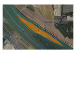
278 eased with NRCS wetland conservation easement, Huntington soils. The tree lined perimeter and an access point is not eased.
The deed / a 1973 survey, describes and additional 34.7 acres around the island from the top of the bank to the edge of the water.
2022 Taxes:
$296
Zoning:
Agriculture / Conserved Wetland
Future Land Use:
Agriculture / Conserved Wetland
Listing ID#:
2370264
Location
37.860138431875 , -87.245642296493
Contact me- I will get you on onto the island. You can see it from
(1) Indiana, Spencer County, take CR150 S to CR. 175 S. There is a boat ramp at the end of CR 850 S
(2) On the Kentucky side From US 60 take Keen Rd. to Laketown Rd.
Known as French Island No. 2. The island is closer to the Indiana side than it is to the Kentucky side.


Land by State
Land Professionals by State
- Alabama
- Arizona
- Arkansas
- California
- Colorado
- Delaware
- Florida
- Georgia
- Idaho
- Illinois
- Indiana
- Iowa
- Kansas
- Kentucky
- Louisiana
- Maryland
- Minnesota
- Mississippi
- Missouri
- Nebraska
- Nevada
- New Mexico
- North Carolina
- North Dakota
- Ohio
- Oklahoma
- Oregon
- Pennsylvania
- South Carolina
- South Dakota
- Tennessee
- Texas
- Utah
- Vermont
- Virginia
- Washington
- West Virginia
- Wisconsin
- Alabama
- Arizona
- Arkansas
- California
- Colorado
- Delaware
- District of Columbia
- Florida
- Georgia
- Idaho
- Illinois
- Indiana
- Iowa
- Kansas
- Kentucky
- Louisiana
- Maryland
- Massachusetts
- Michigan
- Minnesota
- Mississippi
- Missouri
- Montana
- Nebraska
- Nevada
- New Jersey
- New Mexico
- New York
- North Carolina
- North Dakota
- Ohio
- Oklahoma
- Oregon
- Pennsylvania
- South Carolina
- South Dakota
- Tennessee
- Texas
- Utah
- Vermont
- Virginia
- Washington
- West Virginia
- Wisconsin
- Wyoming


