Case Studies
Home builder site acquisition
Challenge:
National Home Builder was seeking to identify new project sites for development in York County, SC (south of Charlotte, NC). They were interested in identifying all properties >20 AC, in favorable school zones and near desirable neighborhoods, within proximity to water/sewer, and suitable site characteristics for development (absence of wetlands/flood plains, heavy topography).
Solution:
NLR created custom mapping platform which screened for the client criteria listed above and included all parcel files (complete with ownership data). Then NLR’s team of land specialists embarked on an acquisition strategy to contact and secure properties for purchase contracts. With NLR’s broad agent coverage and scalable technology we are able to deploy this approach across the country.
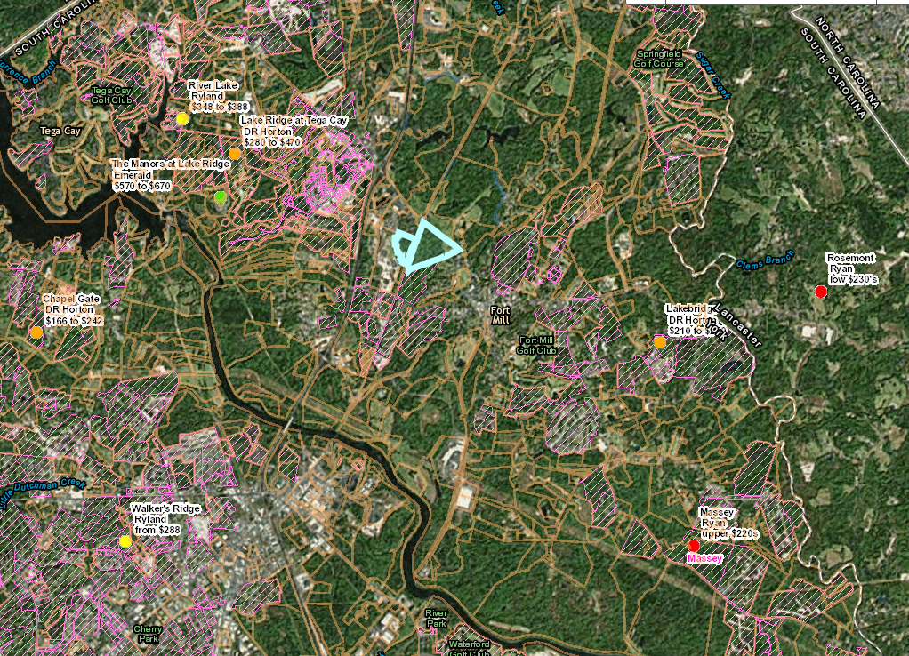
Subdivisions with new building & price points, school districts, utility access, zoning, and more
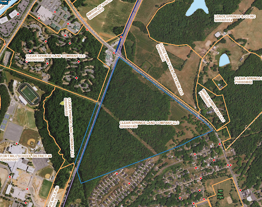
Parcel maps with ownerships and site development factors (floodplains/wetlands/topo)
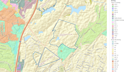
Zoning Maps
Senior Living Site Acquisition
Challenge:
Developer seeking to identify sites for independent and assisted living facilities in Southeastern US. The age and income qualified population as well as the amount of existing inventory is critical to evaluating site feasibility. The developer provided a demographic model which they were using to evaluate sites individually, confining them to their local markets. NLR was tasked with creating an acquisition platform that would allow for regional scale.
Solution:
NLR used the metrics to create a custom mapping platform which highlighted concentrations of the target population, as well as the existing independent and assisted living facilities (including number of beds). This platform allowed the developer to identify target rich areas on which to focus. NLR’s team of land specialists then proactively targeted viable sites within those hot spots to solicit purchase agreements. In the initial project phase three sites were secured and projects are slated for construction beginning late 2017.
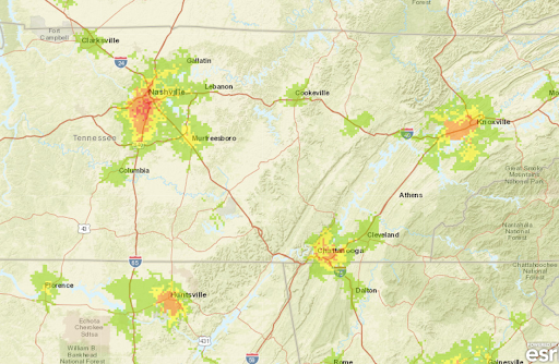
Heat map identifying concentrations of target population
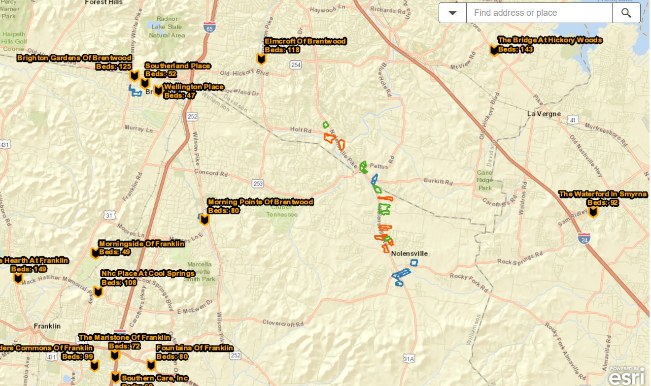
Existing facilities with number of Beds & Parcel data identifying market opportunities
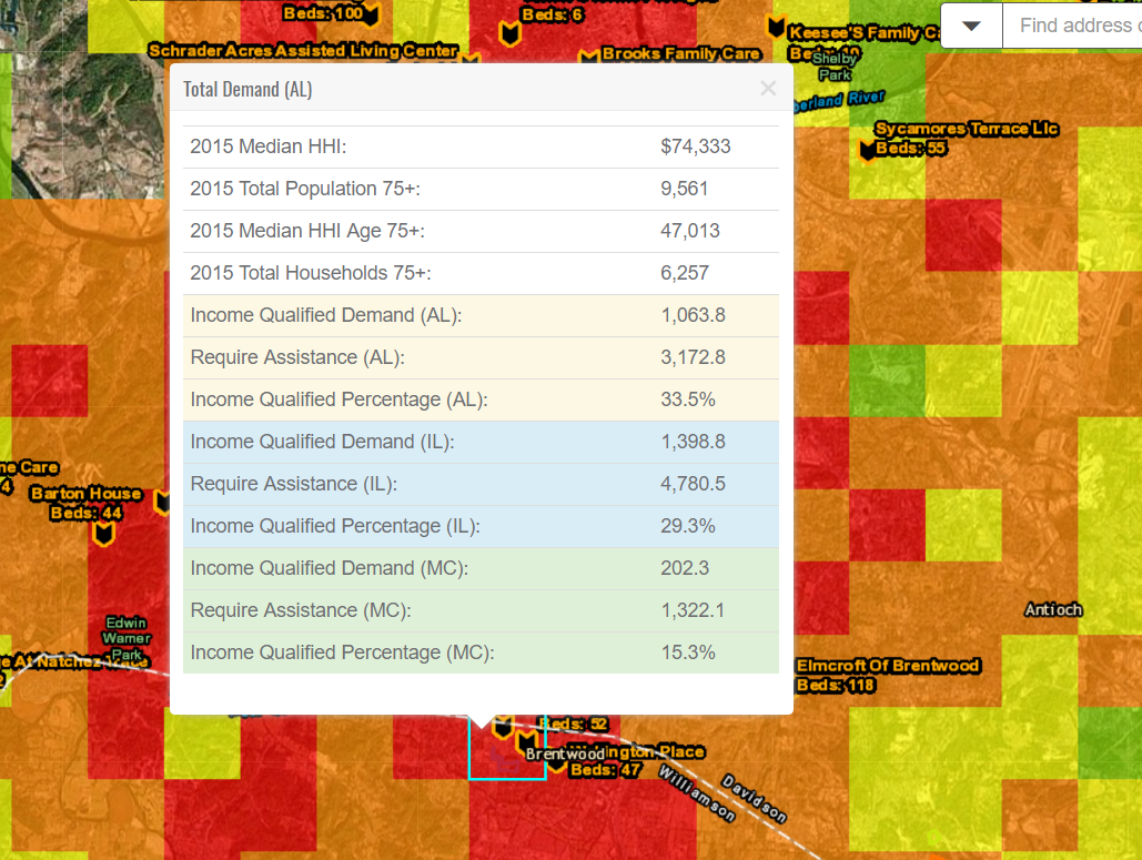
Demographic profiles for IL, AL, and Memory Care segmented by 1 mile Block Groups
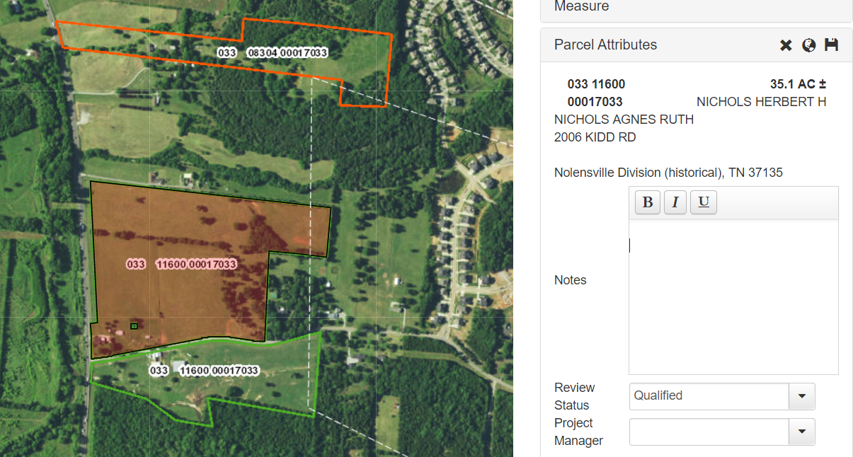
Parcel Maps with Ownership to seamlessly contact target properties
Florida Affordable Housing Site Acquisition
Challenge:
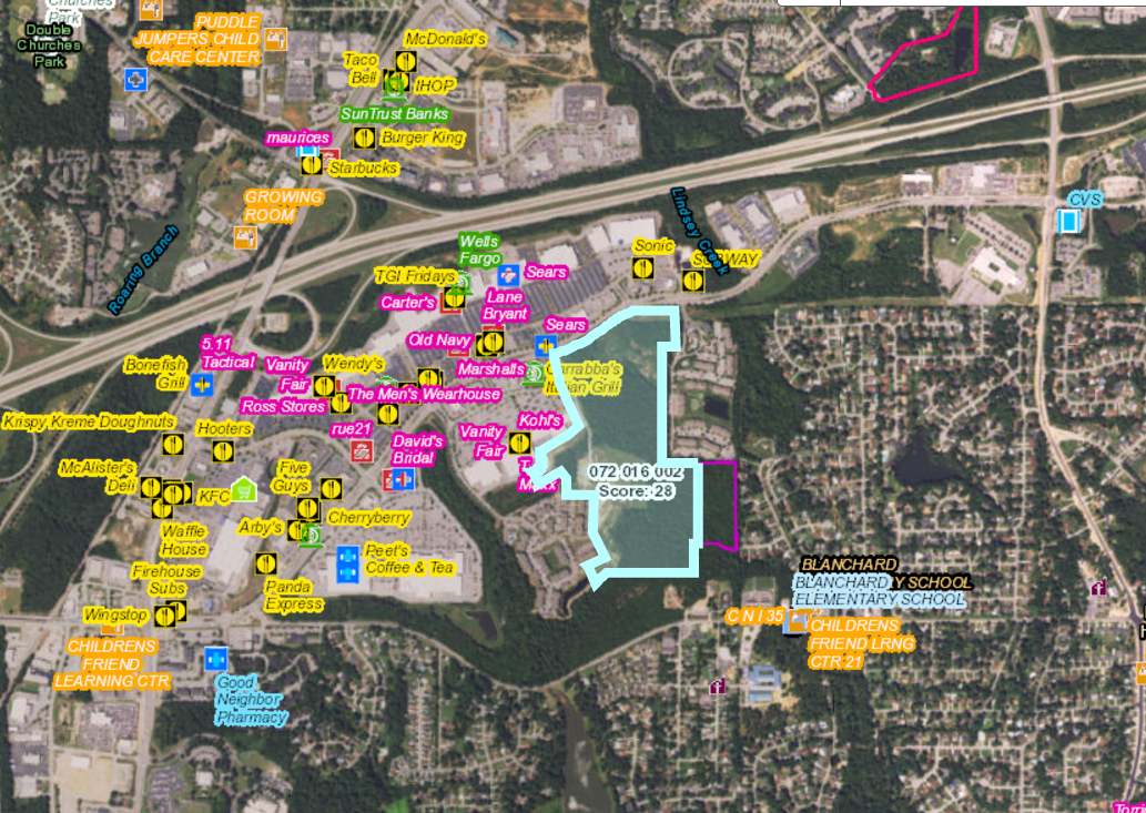
Developer seeking to identify viable sites for multi-family development under the Florida Low Income Housing Tax Credit program. The Florida QAP scoring is calculated based on the site’s proximity to amenities (i.e. grocery, pharmacy, medical, schools) with higher scores associated with the closer amenities. NLR was tasked with creating a custom mapping platform which would automate the scoring process based on geo-spatial computing for all parcels >4 AC in the state of Florida, then employ the team of land agents to contact landowners and secure sites for purchase options.
Solution:
NLR created a custom mapping platform which included all of the amenity point locations in the state of Florida, parcels >4 AC (with ownership info), LDA/DDA boundaries, Qualified Census Tracts, proximity to previously funded projects, bus routes, and site development layers (i.e. wetlands/flood plain, zoning). The resulting qualified opportunities were then targeted by NLR’s team of land agents. Over 400 sites were identified and 10 properties were contracted for purchase.
Maps defining QCT, SADDA, Previously Funded Projects (with buffers) to narrow down target areas
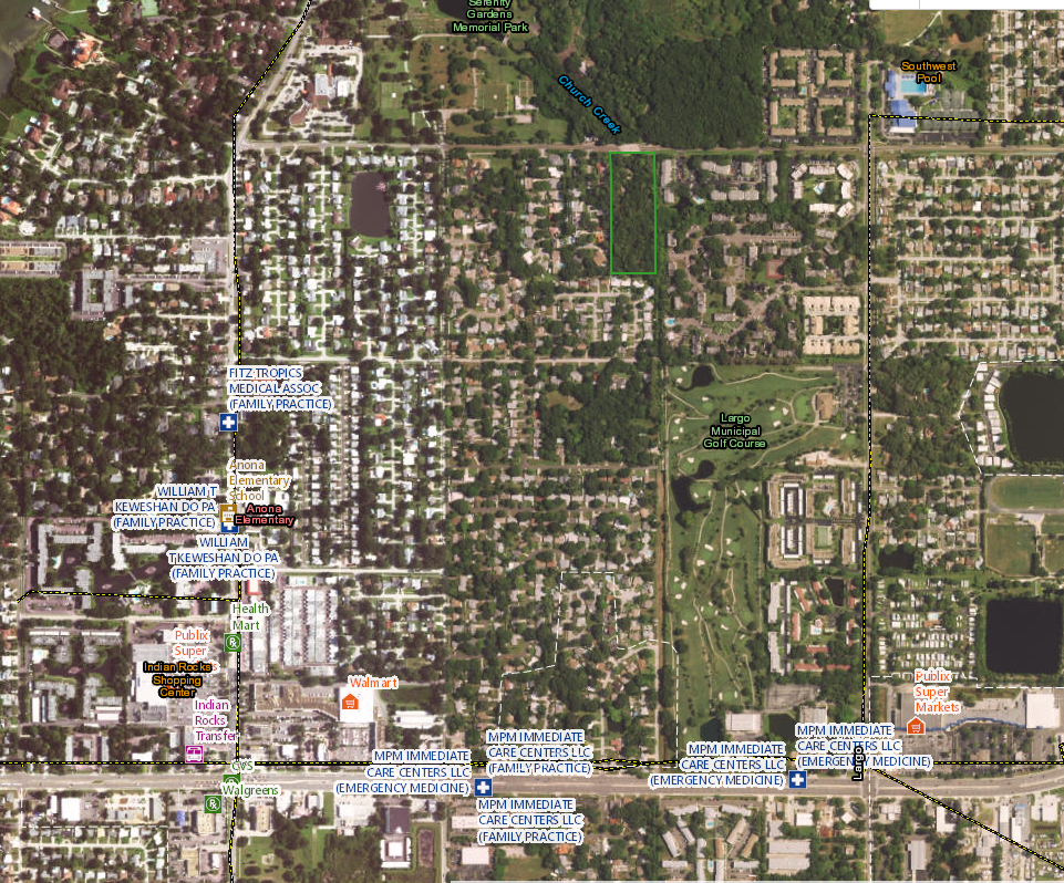
Groceries, Medical, Pharmacy, Schools & Bus Routes used to automatically score parcel data
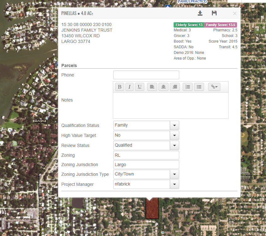
Targeted parcels with scoring breakdown, zoning, & ownership data for contact
Georgia Affordable Housing Site Acquisition
Challenge:
Developer seeking to identify and contract multi-family project sites to submit under the Georgia Low Income Housing Tax Credit program. Projects are awarded based on site scores with criteria including – proximity to area amenities (grocery, medical, pharmacy, banks, public parks, fire stations, and more), high graded school systems, public health ratings, low percentages of poverty, distance to previously funded projects, transportation hubs, and more.
Solution:
NLR built a custom GIS mapping platform which factored in the criteria and automated the scoring of all parcels in the state. High scoring sites which met the appropriate size, zoning, and locational characteristics were targeted by NLR’s team of land agents to secure purchase options.
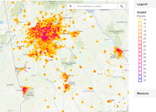
Heat Map showing concentrations of high scoring parcels
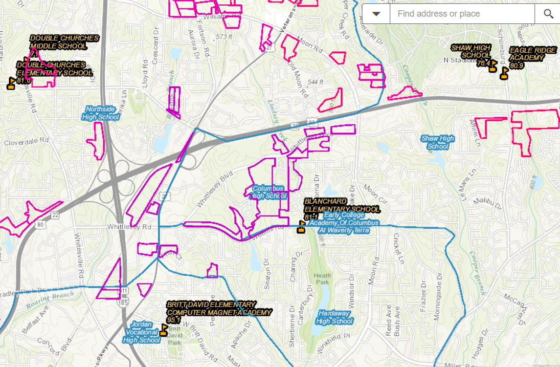
Maps segmenting school districts and high performing schools
Area amenities & parcel scores with ownership data
Greenfield Solar Site Acquisition
Challenge:
Developer client seeking to obtain lease options on suitable sites for distributed generation solar facilities in North Carolina. Site requirements include 10-30 AC, within 3 miles of Substation, 3 phase power on-site, absence of flood plains/wetlands, minimal topography, and within coverage network of select utilities. NLR was tasked with securing 400 sites over a 6 month period.
Solution:
NLR created custom mapping platform which included parcel files (complete with ownership data), utility infrastructure (both transmission and substation data), wetlands/flood, topographic heat maps, critical habitats, proximity to airports and other critical development issues. NLR’s team of analysts systematically reviewed parcels for the entire state and prequalified 20,000 target opportunities. A comprehensive communication strategy was launched by the NLR land agents to educate landowners. NLR then performed a series of qualification steps confirming the site viability including insights on site permitting and development costs (i.e. tree clearing, harvest impacts). The project concluded with the execution of 400 lease options within the target time frame.
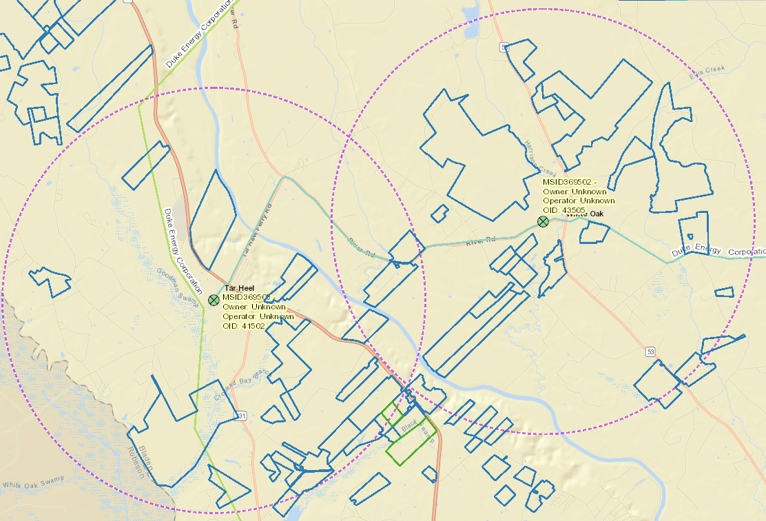
Parcel maps within 3 miles of target substations
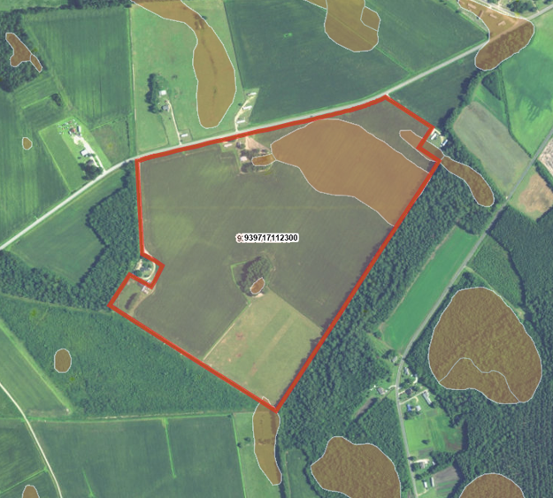
Site screen for flood plains, wetlands, excessive topo, tree coverage/structures
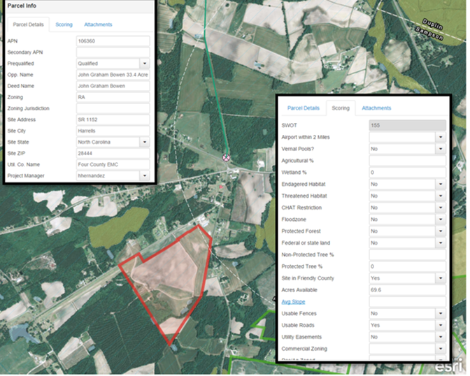
30 point site review & qualification

